
First off import/link the Survey or Architects drawing you are going to use as the base as you would do normally using Centre to Centre.
Switch your view to Project North.
 Then go to Tools --> Project Position/Orientation --> Rotate Project North ..
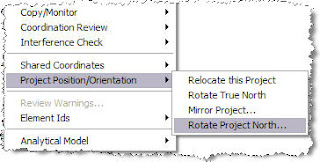 Then just follow the instructions in the dialogue box.
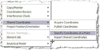
Then go to Tools --> Shared Coordinates --> Specify Coordinates at a point
 Then fill in the dialogue box as required. The units depends on how you linked in your original drawing.
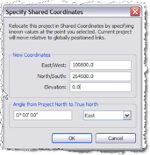
Your Revit model is now co-ordinately correct.
No comments:
Post a Comment